The Rim Fire was a wildfire in the central Sierra Nevada region, in Tuolumne and Mariposa counties of California in the United States. The fire started on August 17, 2013, during the 2013 California wildfire season.[2] It was the third largest wildfire in California's history,[8] having burned 257,314 acres (402.053 sq mi; 1,041.31 km2),[2][9] and is the biggest wildfire on record in the Sierra Nevada.[4] The fire was contained on Thursday, October 24, 2013.[2] The fire was caused by a hunter's illegal fire that went out of control[10] and was named for its proximity to the Rim of the World vista point[11] in the Stanislaus National Forest.[12] Eleven residences, three commercial buildings, and 98 outbuildings were destroyed in the fire.[2]
The fire erupted on August 17, 2013 at 3:25pm
[13] in the Stanislaus National Forest east of
Groveland when a hunter lost control of an illegal campfire.
[14] The hunter has not been publicly identified.
[15] Only 40 acres when it was discovered, it grew to 10,000 acres within 36 hours and 100,000 acres after four days. The rapid spread is attributed to five factors: a record-breaking drought, a heat wave, past fire suppression, population growth, and Forest Service budget cuts.
[16] It burned into back-country areas of
Yosemite National Park. The park remained open, and
Yosemite Valley was never in danger,
[17]although it was affected by heavy smoke at times.
[18]
The blaze was difficult to fight because of inaccessible terrain and erratic winds, forcing firefighters to be reactive instead of proactive. More than 5,000 firefighters
[2] – including more than 650 inmates who volunteered as part of California's
Conservation Camp initiative[19][20] – worked to contain the fire, which was described by a Forest Service spokesman as "a real tiger".
[4] At one point state officials asked residents to avoid social media, to stop exaggerated claims and rumors from spreading, and debunked a number of circulating stories.
[21]
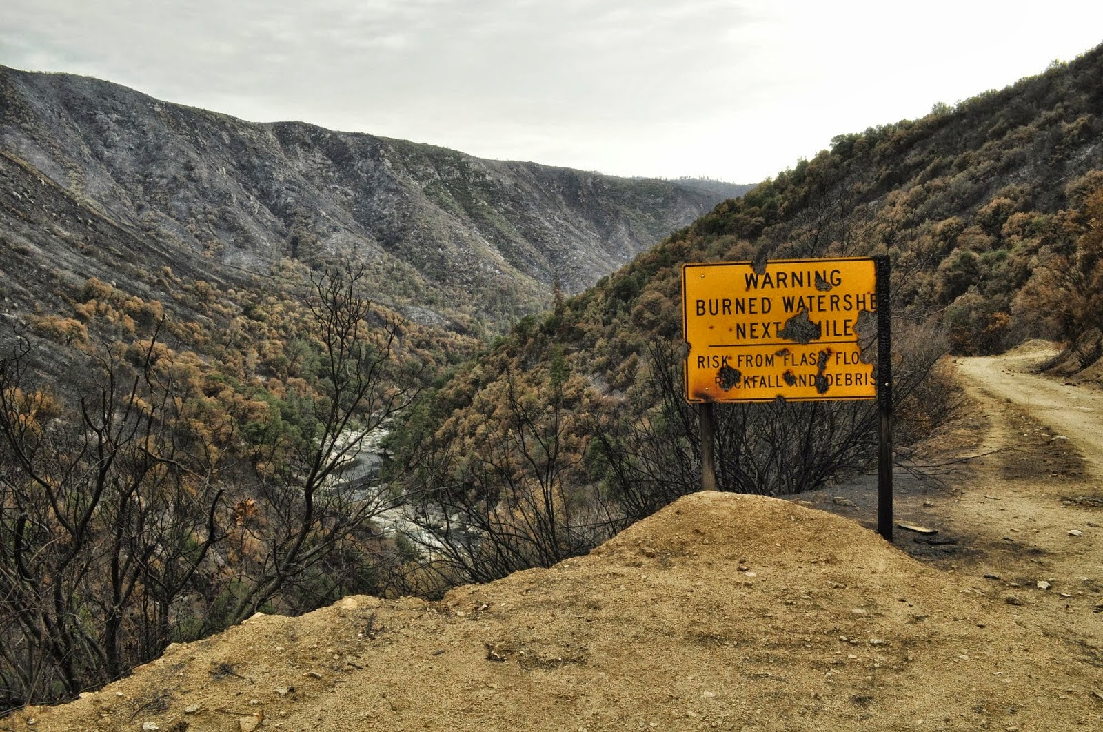
A widespread heat wave and drought conditions helped to spread the fire and make it difficult to combat. Also contributing to the fire was a pre-1980s policy of suppressing small natural fires. The lack of those fires created nearly a century's worth of fuel to burn, resulting in a massive forest fire killing virtually all plant life in its path.
[16] Forest officials estimated "that almost 40% of the area inside the fire's boundary is nothing but charred land" - nearly 160 square miles out of the 400 square miles burned. They said this extent of destruction is "unprecedented" for historic Sierra Nevada fires.
[22] The extent of the fire, however, allows for new succession of tree species that require post-fire conditions to germinate; species that have not been around for quite some time will begin to appear.
[23]
Closures and evacuations
Forest closures were in effect for several areas. Some evacuation advisories were issued by Tuolumne and Mariposa counties.
[2] The
Tioga Pass Road (Highway 120) was closed for a time. Highways
140 from
Merced and
41 from
Fresno remained open throughout the fire, providing access to the national park.
[24]
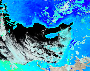
Smoke from the fire caused unhealthful air conditions in
Reno, Nevada and the
Lake Tahoe area during the first week of the fire, forcing the cancellation of several outdoor events there.
[25]
Berkeley Tuolumne Camp, a family camp operated by the city of
Berkeley and established in 1922, was burned to the ground by the fire.
[26] Nearby
Camp Tawonga suffered some damage including the loss of three buildings.
[26][27] Camp Mather, operated by the city of
San Francisco, suffered minor damage,
[28] as did the San Jose Camp run by the city of
San Jose.
[29] Privately owned Evergreen Lodge was undamaged.
[30]
References
- Jump up^ [1]
- ^ Jump up to:a b c d e f g h i "Rim Fire". InciWeb. Retrieved 24 October 2013.
- ^ Jump up to:a b "Rim Fire". Fire Tracker. KPCC. Retrieved 6 October 2013.
- ^ Jump up to:a b c "Firefighters gain ground on still-growing Yosemite wildfire". CBS News. August 27, 2011. Retrieved 27 August 2013.
- Jump up^ DeLuca, Matthew (24 August 2013). "Emergency in San Francisco as wildfire threatens city's power grid". NBC News. Retrieved 26 August 2013.
- Jump up^ Rim Fire continues to burn
- Jump up^ Swaffer, Gar. "Firefighters gaining, but Rim Fire increases to 187,466 acres". Digital Journal.
- Jump up^ "Rim Fire Becomes Third-Largest Wildfire In California History". CBS Channel 13, Sacramento. 29 September 2013 (revised). Retrieved 15 October 2013.
- Jump up^ "California's fourth-largest wildfire fills Yosemite Valley with smoke on holiday weekend". NBC News. Retrieved 1 September 2013.
- Jump up^ "Yosemite Wildfire Started By Hunter's Illegal Fire, U.S. Forest Service Announces". 5 September 2013. Retrieved 5 September 2013.
- Jump up^ Rim of the World Vista - Stanislaus National Forest 37.821949, -120.039153
- Jump up^ "Wildfire Rages to Yosemite's Edge in Hot, Dry Weather". 23 August 2013. Retrieved 26 August 2013.
- Jump up^ California Department of Forestry
- Jump up^ Cone, Tracie (September 6, 2013). "USFS: Hunter caused huge wildfire near Yosemite". Yahoo! News. Associated Press.
- Jump up^ Klein, Karin (September 16, 2013). "What's happened to the hunter who sparked the Rim fire?". Los Angeles Times. Retrieved 19 September 2013.
- ^ Jump up to:a b Abrams, Lindsay. "The 5 Factors Fueling the Rim Fire".
- Jump up^ Foley, James A. "Rim Fire Continues to Threaten Yosemite National Park". Nature World News. Retrieved 26 August 2013.
- Jump up^ Fieldstadt, Elisha (September 1, 2013). "Rim Fire at 225,000 acres as Calif. officials search for cause of massive blaze - U.S. News". NBCNews.com. Retrieved 2 September 2013.
- Jump up^ "California Inmates Help Battle Raging Yosemite Rim Fire". Huffington Post. 30 August 2013. Retrieved 1 September 2013.
- Jump up^ Rawlings, Nate (31 August 2013). "California’s Prison Problems Won’t Extinguish Inmate Firefighters". Time. Retrieved 1 September 2013.
- Jump up^ Carroll, Rory (Tuesday 27 August 2013 13.29 EDT). "California officials ask residents to avoid social media for Rim fire updates". The Guadian. Retrieved 27 August 2013.
- Jump up^ Cone, Tracie (September 19, 2013). "Nearly 40 Percent of Rim Fire Land a Moonscape". ABC News. Retrieved 19 September 2013.
- Jump up^ "As Rim Fire landscape shows signs of new life, scientists begin to assess forest management". Washington Post. Associated Press. September 27, 2013. Retrieved 27 September 2013.
- Jump up^ Lopez, Robert J. (August 27, 2013). "Spot fires, intense flames rage as crews fight Yosemite Rim blaze". Los Angeles Times. Retrieved 27 August 2013.
- Jump up^ "Smoke from CA wildfires clears over NV". Associated Press (KRNV-DT Reno). August 25, 2013. Retrieved 26 August 2013.
- ^ Jump up to:a b Fernandez, Lisa (August 27, 2013). "Campers Mourn Loss of Berkeley Tuolumne Camp; Camp Tawonga Saves Torah". NBC Bay Area. Retrieved 21 November 2013.
- Jump up^ "Rim Fire burns three buildings at Camp Tawonga". J Weekly. August 29, 2013. Retrieved 21 November 2013.
- Jump up^ "Camp Mather Update". San Francisco Recreation and Parks. August 30, 2013. Retrieved 21 November 2013.
- Jump up^ "Yosemite Rim Fire slows but threatens water supply, burns Bay Area camps". San Jose Mercury News. August 26, 2013. Retrieved 21 November 2013.
- Jump up^ "Evergreen Lodge- reopening September 10". Evergreen Lodge Yosemite. Retrieved 21 November 2013.